Plan and dispatch
Create the work order, set priority and deadline, and send it to the right technician with the day’s route already built.
Field Service Management (FSM)
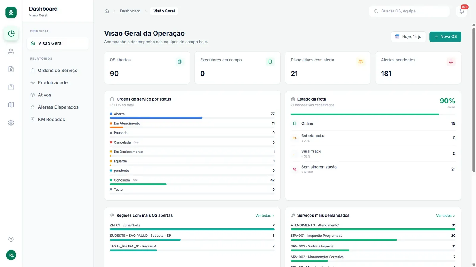
Geosite Field Teams brings work orders, routing, GPS tracking and digital forms together on a single platform. The app works 100% offline and syncs everything by itself once the signal returns.
If the answer to "where is the team right now?" still depends on a phone call, your operation is paying for it every single day.
The technician leaves in the morning and the next reliable update only arrives at the end of the day
Work orders scattered across spreadsheets, paper and WhatsApp, with no history and no priority
Routes improvised on the fly: more kilometres driven, fewer jobs per day
SLAs breached without warning. You find out from the client or from the penalty
Productivity, kilometres driven, cost per job? Nobody knows for sure
An area with no signal turns into paperwork, photos on WhatsApp and lost data
You can have full control of the operation without changing your team or your processes. Here's how.
Market averages from organisations that digitised their field management — the kind of gain Geosite was built to deliver.
It is the name of the software category that organises the work of everyone operating away from the office. If your operation has technicians out on the road, this is it.
Create the work order, set priority and deadline, and send it to the right technician with the day’s route already built.
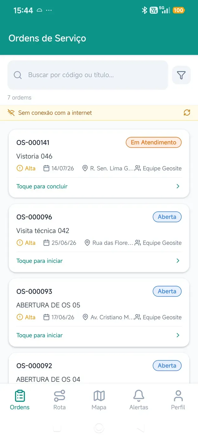
The technician receives the order on their phone, fills in the form, attaches a photo and captures the signature. With no need for a signal.
Every job is recorded with a timestamp and coordinates, and becomes a number at the end of the month: productivity, SLA and distance driven.
Geosite Field Teams is Geosite’s FSM platform. The app technicians use in the field is called Geosite FSM and is available on Google Play. View Geosite FSM on Google Play
Every field operation comes down to one cycle. Geosite Field Teams handles each stage of it, and this page follows exactly that order.
From planning the work order to the technician in the field and the manager following everything on the map: the platform working end to end.


What used to live in a spreadsheet, a message group and somebody's memory becomes a traceable record from the very first second.
From low to urgent, with the deadline monitored. The platform warns you before the deadline is breached, not after.
Every month's preventive maintenance is created automatically, on the right day, without relying on anyone's memory.
Who created it, who changed it, when the status moved. An evidence trail ready for public sector contracts.
The whole week's schedule appears on a calendar, organised by team or by service type.


Select the day's work orders and choose the mode of transport: car, motorbike or on foot. The platform calculates the best sequence of stops, with an estimated time for each one.
In the example alongside: 5 stops, 38.9 km and an estimated finish before midday.
The route appears in the technician's app instantly, numbered in order with a summary of distance and time.
The Navigate button opens Google Maps with the destination ready. Nobody types an address, nobody gets the wrong gate.
Fewer kilometres driven, more work orders completed per technician per day.
Your technician works where the job is, not where 4G reaches. Warehouse, rural area or basement: the work order opens, the form is filled in, the photo is attached and the signature is captured. Everything is saved on the device itself.
A tour of the technician's screen: the day's work order queue, the form filled in with photo and signature, and automatic syncing as soon as the signal comes back.


Checklist completed offline
The day's queue, available offline

Automatic sync: nothing is lost
Working without internet is not a plan B. It is simply how the app works day to day.


Every service has its own form, built by the people who know the operation. What the manager designs on the computer appears exactly the same in the technician's app.
Text, number, photo, video, audio, digital signature, geolocation, barcode and more.
If the technician answers "No" to "Equipment working?", the fault fields appear. The form adapts to every answer.
A photo with coordinates and the client's signature attached to the answer. Proof of execution ready for auditing.
On a phone it becomes a simple screen: tap, answer, photograph, sign. Offline, too.


Equipment, network points, meters, structures: anything with a location becomes an asset on the platform.
Model your inventory your way, with the types and attributes of your operation.
Upload an XLSX or CSV spreadsheet, map the columns and review the validation before confirming. Thousands of assets in minutes.
The technician draws on the phone screen, on site, and the asset is born georeferenced, with a photo and attributes.
The inventory stops being an outdated spreadsheet and becomes the living layer on which every work order happens.
Real-time map, GPS tracking and geofences: three ways of seeing the same operation. No phone calls, no WhatsApp, no guesswork.


The entire operations centre on one screen, updated in real time and organised into independent layers.
Toggle field staff, work orders by status, assets and geofences. The map shows only what matters at that moment.
Click any pin and see the status, priority, battery level and signal of the technician's device.
One click and the map becomes the operations centre display: clean and full screen.
The technician sees the same map in the app, with work orders sorted by distance and the next stop always to hand.

The app sends its position in the background, even with the screen off, and adjusts the sending interval to preserve battery.
Review any day's journey, including how long was spent at each stop.
Mileage for reimbursement, time on site for invoicing, proven attendance when a job is disputed.
Tracking with clear rules: GPS only records on the working days and hours you configure. Outside working hours, nothing is collected. It stays transparent for the company and for the team, in line with Brazil's data protection law (LGPD).


Draw the area straight on the map: circle, polygon or route. The system does the rest.
Know when the technician arrives, when they leave and whether they stayed longer than expected.
Configure it to prevent a job starting outside the fence. Ideal for control by lot, district or contracted area.
For anyone operating by contracted area, it is the difference between trusting and verifying.
And the platform adapts to your operation, not the other way round.

Work orders, productivity, assets, alerts and distance driven, with filters by period and charts ready to go. Closing the month stops being a full day of manual work. And the data is yours: just export it.

Name, colour, icon and order of each status, configurable by dragging, with no code. From "Awaiting part" to "Inspection approved", the system speaks your team's language.

New work order, rescheduling, SLA nearing its deadline: a push notification straight away, with an inbox in the app. The alert doesn't get lost in the WhatsApp flood.
Too complete to be a simple tool. Too simple to cost like an ERP.
| Feature | Geosite Field Teams | Corporate ERP | Generic work order apps | Spreadsheet + WhatsApp |
|---|---|---|---|---|
| 100% offline app | ✓ The normal way to operate | ◐ Rare or limited | ◐ Partial | ✗ |
| Routing with estimated times | ✓ Automatic | ◐ Separate module | ◐ Basic | ✗ |
| Georeferenced assets on the map | ✓ Point, line and polygon | ◐ Requires a separate GIS | ✗ | ✗ |
| Configurable work order flow | ✓ Visual, no code | ◐ Via consulting | ◐ Fixed | ✗ |
| Distance driven per technician | ✓ Automatic, on the dashboard | ◐ | ✗ | ✗ |
| Implementation | ✓ Weeks, dedicated team | ✗ Months + consultant | ✓ | ✗ |
| Customer support | ✓ Specialised in field work | ◐ | ◐ | ✗ |
Comparison against categories of market solution, not specific vendors. ✓ full · ◐ partial · ✗ not covered
Every sector has its own pain. The platform adapts to all of them.
Geosite Field Teams runs on Google Cloud infrastructure with an Oracle database, the same foundation that has supported critical operations for public and private clients for over a decade. Dedicated support, guided implementation and a team that understands field operations, not just software.
Talk to a specialistTell us in two lines how your operation works: how many teams, what kind of service and where it hurts most. A specialist will reply within one business day to schedule a demo, with no obligation.
Thank you for your interest. One of our specialists will be in touch shortly.